-
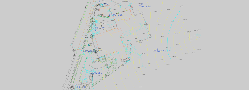 Topographical Surveys
Topographical surveys are used to map the shape and form of a site. It depicts the topography or the “lay of the land”. We can survey external site areas, observe boundary details, surface change, all physical structures, trees as well as vegetation. -
 Measured Building Surveys
Whether you are looking to refurbish or redevelop an existing building or simply add an extension to it. Oakfield Surveys can quickly and accurately gather all of the required information on site, from elevation surveys to identifying the floor layout plans for change of use, licensing agreements and floor space management. -
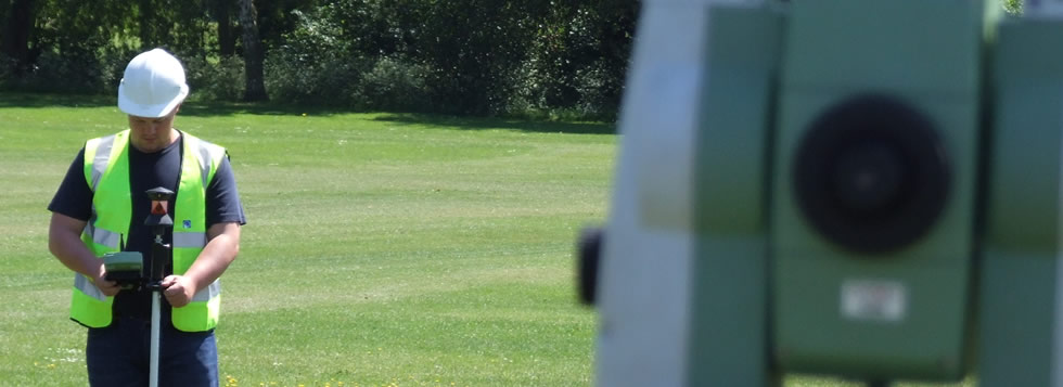
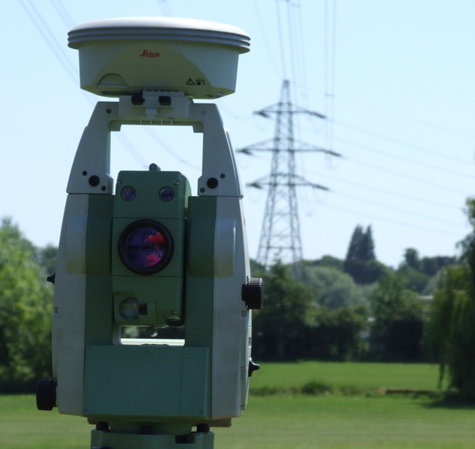
 GPS Surveys
The range of GPS tasks undertaken varies considerably; from purely using base stations to co-ordinate the survey stations for a traditional topographical survey project, to "roving" across vast areas of land giving instant 3D co-ordinate data across the site terrain. Projects have included large areas of green field sites for, wind farms, pipeline routes, development projects and road schemes. -
 Site Setting Out
Our beginnings were in Site Engineering Services which is something we have been conscious to maintain. Carrying out work both in house and for various clients from Groundwork/Civil Engineering contractors like ourselves, to main contractors both local and national, setting out roads and sewers, house foundations, raft foundations, concrete/steel framed structures, car parks etc. -
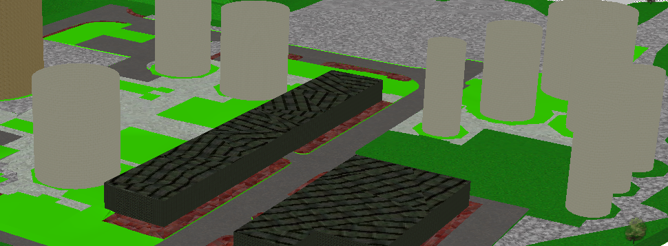 3D Laser Scanning
Advances in technology have brought the scope for large scale 3D laser scanning into everyday use. The 3D scanner will produce high definition surveys capturing up to 50,000 points per second.
Topographical Surveys
 Topographical surveys are used to map the shape and form of a site. It depicts the topography or the “lay of the land”. We can survey external site areas, observe boundary details, surface change, all physical structures, trees as well as vegetation. The survey can be carried out using GPS and overlaid onto an ordanance survey map. This is a common criteria for designers as it allows them to see the true location and levels of the survey.
Measured Building Surveys
 Whether you are looking to refurbish or redevelop an existing building or simply add an extension to it. Oakfield Surveys can quickly and accurately gather all of the required information on site, from elevation surveys to identifying the floor layout plans for change of use, licensing agreements and floor space management. We use the latest software packages, and export them to the client in Auto CAD format, either in 2D or 3D.
GPS Surveys
 The range of GPS tasks undertaken varies considerably; from purely using base stations to co-ordinate the survey stations for a traditional topographical survey project, to "roving" across vast areas of land giving instant 3D co-ordinate data across the site terrain.
Projects have included large areas of green field sites for, wind farms, pipeline routes, development projects and road schemes.
About Oakfield Surveys
Our beginnings were in Site Engineering Services which is something we have been conscious to maintain. Carrying out work both in house and for various clients from Groundwork/Civil Engineering contractors like ourselves, to main contractors both local and national, setting out roads and sewers, house foundations, raft foundations, concrete/steel framed structures, car parks etc.
Oakfield Surveys News
© Copyright 2010 Oakfield Surveys ![]()